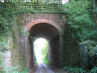


 We headed back into Bircham Wood and picked up the track which led back to the starting bridge over the steep hill which the track detours around. I'd taken a stick with me today and when I got to the bridge I felt it knock on something solid. On further inspection I had discovered my first railway sleeper of the project. In fact there were a few here, with square GWR bolts too.
 Not only were the sleepers camouflaged under the early autumn leaf fall, but the bridge was very camouflaged too. It was very overgrown and much higher than the stonework. Maybe some earth had been piled on it, as the vegetation seemed to thrive here.
 When we got to the other side it was pretty difficult to pick up the trail. We went back and forth several times. I thought I'd found the track straight away, but a two foot ridge across the track made me wonder if this was right. In the end we decided it must be, and carried on. Besides, even the topo map had this marked as a path, though I can't imagine anyone had been down here for a very long time. We found ourselves in Whitecliff Quarry; no fences; no gates. The quarry (now a 4x4 centre) was deserted, so we quietly followed the line we had plotted for the track. The yard contains loads of relics, like old diggers, an ancient steam engine, a restaurant car awaiting reconstruction and many, many more.
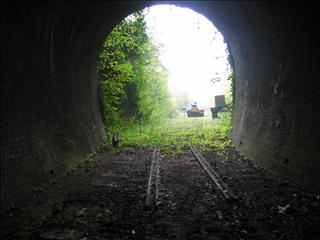
 We didn't hang around too long and soon found ourselves at the mouth of another small tunnel. This one was about 270 feet and really clean. A tiny section of rails was present, though the gauge seemed rather small, and some more rails lay outside. (See, I do know some railway terms). The rails were mounted on concrete blocks rather than wooden sleepers. The far end was partially blocked by corrugated iron and barbed wire, but was impassable. We zigzagged up the road to the quarry itself. I've often walked along the top to the Scowles, but it seemed even bigger from here. I'd managed to mark the far end of the tunnel on the GPS, so we navigated to that point, though it proved impossible to get there from where we were as we had climbed higher than we'd imagined. After half an hour of trying we decided to call it a day. We had been on the other side of the tunnel, or close by, a few times before and knew it was easy enough to get to.
Days Summary
Another great days tracking. We only did 5 miles today and uncovered rather less track than we had anticipated as we wanted to do all the way to Coleford, but the going was much harder today. At least we got a pretty difficult stretch under our belts. Again we discovered two tunnels and two bridges, one of which we knew nothing of. I had walked the section from Whitecliff bridge towards Newland once before, but had stopped well before reaching the new bridge. This was when I was first discovering the area.

Track notes
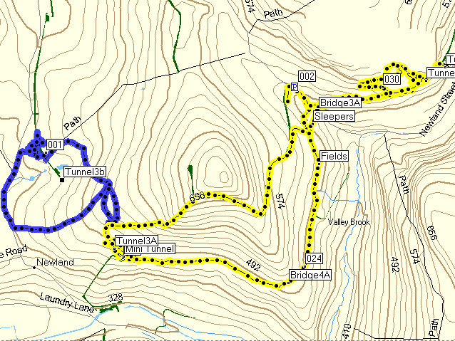
We started at 001, without really tracing any track, then drove to 002 and headed south doing the clockwise route then passed the car to do Whitecliff
The lowercase b on Tunnel3b denotes it is an estimate from map information rather than a marking by GPS.
I don't think I'll provide the gpx files until I've completed a section of track, then I'll supply it for the track only, cutting out my return routes and detours.
I will integrate this map into the OS map above.