Garmin Monterra and the future of Garmin

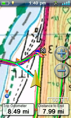
Until a few years ago if you wanted a GPSr you had little choice but to go to Garmin. Competition was very weak and Garmin products were good, but things have changed. While the historic competitors have failed to up their game the smartphone market rode into town, bringing with it larger high resolution displays, slim easy to use devices that Monterra
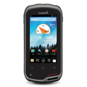
offered so much more. Now you can have one device that sees the geocaching process through from end to end, from pulling data via 3G or wi-fi, to on-line access to geocaching.com while out in the field, to finally logging your find on-line along with posting photos taken on your smartphone. And when you’re out walking or caching who doesn’t take a phone with then anyway? The biggest benefit is that many of us already have these devices, so there is no additional cost associated with them.

So why do people still buy dedicated handheld units? It’s simple. There are a few critical issues with smartphones:

  • GPS antenna / chipset does not provide as good and accurate positioning
  • Non-rugged hardware means the units can damage easily
  • Non-waterproof hardware
  • Battery life is poor

Garmin are about to release the Android based Monterra to bridge this gap, but what does it really bring to the party. The items on my list are simple hardware issues. Phone manufactures won’t address these issues because they add cost, are not mainstream requirements and may make their devices considerably larger and therefore less desirable. GPSr users are used to carrying around large clunky devices, so getting around power issues (and Android really does guzzle power) is easily solved by adding a large housing that takes three AA batteries or a rechargeable lithium-ion battery. Garmin claim 22hrs on the rechargeable battery, but we all know to take these specifications with a pinch of salt. Sadly, what Garmin have done is to remove many of the benefits of an Android phone. There is no phone, no data (3G/4G). So we now need to carry a separate phone and we can’t interact with the data that is so central to geocaching whilst outdoors. Wi-fi is still available, but that’s not much use if like me you are generally out on the hills. While the device can record 1080p video (I don’t know how good it is though) it can only display a paltry 272 x 480 pixels. That means the HTC One has 16 times more detail on the screen. I believe this is part of the power saving exercise.

The Google Play Store is available on the device, and this could be Garmin’s downfall IMHO. Sure, if it wasn’t available some users would soon find a way around that, but by opening up the Play Store you can put any Android app on you want. This also means that the Garmin software becomes pretty much redundant (there are always people prepared to write this stuff for free and it’s usually better that the bundled software) and more importantly they will no longer get revenue from selling maps. It’s good news for the user. Personally I hate that if I buy a Garmin device I am tied down to some pretty poor maps and at a large cost. Now you can just install your favourite Android mapping application and associated off-line maps. If you don’t have a better Android (or other smartphone) device you could also install an offline sat nav app, though these are not free of course. WhereYouGo (the Android replacement for Wherigo), Munzee and a host of other GPS related apps could also be installed.

All it takes is for an electronics giant to see a profit and they will make an rugged Android phone with a good antenna/chipset and a large battery option and it’s bye-bye Garmin. No expensive software development or support is required. While they’re at it they will add in the phone and data connectivity and Garmin’s effort will be kicked into touch. The arguement for no phone appears to be battery conservation, but turning the phone (and data) on/off  on Android couldn’t be any easier. The final nail in the coffin is the cost. The Monterra is retailing for a whopping £600 (minus 1p). This comes with the totally useless base map and the only slightly more useful recreational map of Europe. There are also no details on Android version, processor, RAM, how speakers deal with being IPX-7 waterproof etc.

Of course dedicated GPS receivers also come with 3-axis compasses, barometric altimeters and the Monterra even has a UV meter (though it didn’t work in the review I saw), but these are much less important. Personally I’ve never seen much difference in practical terms between the 2-axis and 3-axis compass and all barometric altimeters on these devices are pretty much useless (and they drink batteries).

The release date has been put back several times now, but I’m sure that Garmin will make sure it’s out in time for Christmas regardless of whether it works or not. Garmin have a poor record in recent years when it comes to releasing new products as they have been full of bugs, but unlike Magellan they do at least address the issues and try to fix them. Santa can relax though, because I won’t be asking for a Monterra this Christmas.

Posted in Geocaching, GPS and Maps | 4 Comments

New elevation data on this site

I had been pretty disheartened by the poor accuracy of the elevation data from my Magellan eXplorist 710. I guarantee there is no walk I’ve done that I couldn’t make a better estimate at the total ascent that this GPSr can. The device can take elevation readings from GPS, built in barometric altimeter or from it’s topographic maps. All methods are rubbish. I believe my old Garmin 60CSx used to massage the GPS and altimeter data to come up with something much closer to reality. I’d also tried other web sites, but their results were grossly exaggerated too, so I decided to build my own process. I had been using the geonames web service to return SRTM elevation data, but after some research found an excellent article entitled SRTM & Ordnance Survey Elevation Data in PHP. The process involves having the elevation data in files on the web server. The data is laid out in a very structured way within the files so a pointer can direct a call to the precise data elements required very quickly and requiring very little server resource. This is much quicker than loading the data into a database for instance.

There were two problems with geonames. Firstly it was relatively slow (it’s a web service) and secondly, there are limits to how many requests you are allowed to make. This isn’t a problem for this site, but it was for mapRoute.

SRTM data has data for pretty much the surface of the planet taken at 90 metre intervals. This should be enough for my purposes. There is some OS data that’s also freely available that details the UKs elevation at 50m intervals, but it requires the location to be sent in British Grid Reference format, which I haven’t got round to looking at yet and from brief research I know it won’t be easy. (Update: I have since implemented British Grid Ref. conversion in mapRoute, but to the OS elevation data).

The issue with map related elevation data often arises when you are walking at an angle to a very steep incline, say along a cliff top. The GPS measurement only needs to be a few feet out and it will report you as being at the bottom of the cliff, then the top etc. In fact, if you have elevation data for every 90m only you could still see this problem even with an accurate GPS track log. I walk a lot in the hills, so this is a significant issue for me.

Historically I have reduced my track log points to just 100 before uploading to this site as I didn’t want too much data slowing down the process. Imagine the situation when you’re walking along a concave cliff top or ridge. In reducing the track points a straight line between two separated points now has you down at the bottom of a cliff given the above example.

Another issue occurred when two points were at a similar elevation, but somewhere between them the elevation changed considerably. Imagine walking over the top of a hill, but the only elevations recorded were at the base of the hill on either side. This scenario would report no ascent being made. The code provided by osola allows for creating intermediate points every 3″ (seconds) of a degree, which equates to approximately 90m. This too makes the resulting elevation profile too jumpy for my purposes, so I added an option to alternatively display at 6″ intervals. There’s no precise science to this. It’s not always the same interval that works best for a route, hence leaving the option to the user.

Integrating the data into a graph meant I needed to return the distance of each point from the start of the route as each section is not of equal length. I would then plot a scatter graph and join the points, so it looks like a line graph. This is where the process fell down when I originally looked at it using GPSr elevation data. Then the graph looked great, but was not accurate. For instance, the peak of a hill may not appear to be the same distance into the route on the graph and on the map. The only point locations you could guarantee were the first and the last. Returning the distance for each point gets around this issue. Alternatively you could return points at fixed intervals only.

Along the way I Ajax-ified the returning of the data and returned the data as JSON. This led on to adding Ajax to much of the site (particularly the walk page). Then I noticed how all my pages were built on HTML tables. This is considered bad practice these days, so I then went about replacing them with DIVs and CSS. Finally, I unified my buttons and made may waypoints display on all relevant routes, not just the one they had been created against.

All of the above was a great learning process, which meant I could then plug in very similar code to mapRoute. The returning of data was so quick that I was even able to return the cursor location elevation as the user moves it across the map. Note: This is turned off for basic users. I only downloaded the data for the UK (344MB), but apart from disk space and download effort there’s no reason why you couldn’t get data for any location.

Posted in GPS and Maps, Walking, Web site | Tagged , | Leave a comment

Justin Currie at The Gate, Cardiff

History

I first discovered the delights of del Amitri in the mid eighties when the eponymously titled del Amitri album ignited something within. I loved the intertwining guitars, the stunningly crafted pop songs, the lyrical imaginary and the beautiful vocals.  The album has remained in my top 5 all time albums to this day with songs like “I was here”, “Heard through a wall” and “Keepers” being examples of near perfect songs in my book. I saw them play a few times back then in London’s Marquee and at a tiny venue in Harlow (Square One) where I first saw The Dentists, another band which I went to see many times in the mid to late eighties. The Dels disappeared of the music map for a few years and I thought they were gone forever. There was no Internet then to find out what a small band was up to. It transpired that they had been dumped by their short-sighted record label, Chrysalis. They re-emerged in 1989 with a complete change of sound, image and record label (A&M). I remember seeing their first London gig at the Borderline club with just a handful of other people. At first I was cautious of the new sound, but was soon brought over to the dark side of MoR Americanised rock/pop. The rest is history.

I carried on seeing them play live for the next few years before parting ways. I’ve always continued to buy their product and now prefer the Justin Currie solo work (and the first album of course).

The gig (19/9/2013)

The Gate arts centre in Cardiff is a tradition church that’s undergone conversion. It’s a lovely little venue. About 5 rows of cushioned pews surround three sides of the hall in what was once the balcony. A false floor has been put in at the base of the old balcony. The stage was a little low and when Justin sat to play keyboards you could barely see him, but otherwise I can’t fault the place. The support act was Del somebody from Canada. The ex rancher delighted the audience with his cute hick tales, strong vocals and capable guitar work.

IMAG0507

I’m of a similar age to Justin, and as he formed del Amitri in 1983 you should be able to work out my age group. I don’t go to many gigs these days (us old fogies don’t), but I was shocked at how old the audience was. I was possibly below the average age. My son (15) is a big fan and he was probably the only one there under 30.

Justin appeared to great applause and after explaining that a “real musician” would appear later he went into the catchy “Every song’s the same”. Half way through he bent down for something and the guitar cut out. Not a great start. After a bit of cable and guitar interrogation, normal service was resumed and the song was completed. The “real musician” did come on later, but was very disappointing. I would rather have heard Justin playing unaccompanied rather than listen to the random sliding of a bottleneck over guitar strings.

I’ve just learned that del Amitri are reforming for a tour in early 2014. It’s a shame that Justin can’t leave the old stuff for then. I really wanted to hear songs like Walking through you, Something in that mess, You’ll always walk alone or As long as you don’t come back. Even older stuff like The Uncle Devil Show‘s comical She cuts here own fringe or the beautiful yet sad reflection on his musical career of Just getting by from the final del Amitri album, Can you do me good? The current single Bend to my will wasn’t even played. The first half of the show was good, but it decayed into a nostalgic sing-a-long, something I would have thought Justin would have hated.

The chap in the row behind me summed up the majority of the audience. “I (retrospectively) bought their first album. It was rubbish.” You sir, are a buffoon and shouldn’t be allowed into a record shop or gig. The reality is that Justin’s solo material along with del Amitri’s first album are by far his best contributions. The MOR stuff in between is good, but it’s not in the same class.

There was an embarrassing moment in “No Surrender” when Justin clean forgot the lyrics mid song. It’s a lengthy rant with a colossal number words in his defence. He thought for a while in silence, then declared his regret that he had lost the thread and just couldn’t get back into the prose. In the many hundreds of gigs I’ve been to I’ve never seen this happen before. Not one member of the audience could help him with the next line, which says a lot in itself. For my part, my memory isn’t as good as it once was!

I came away feeling a little sad that such a talented man was reduced to peddling his “hits” for a bunch of middle aged beardies that just wanted re-live times that they missed out on all those years ago. Go and see the ageing del Amitri if you want to hear del Amitri songs (btw £50 a ticket is a ridiculous price). Having done that many times in the 80’s and 90’s I wanted to hear some great new material (as we did back then) rather than listen to the old punters wail along to “Nothing Ever Happens”.

  • Every song’s the same
  • Food for songs
  • Priscilla
  • Into a pearl*
  • The way that it falls*
  • Whiskey remorse
  • The last to know
  • Half of me*
  • If I ever loved you
  • Falsetto*
  • I hate myself for loving you
  • Driving with the brakes on
  • This side of the morning
  • Tell her this
  • Jimmy blue
  • Stars*
  • Sleep instead of tear drops*
  • Still in love*
  • No surrender* (cut short)
  • Nothing ever happens
  • Be my downfall

All songs played by Justin on guitar except *piano

Posted in Music | Leave a comment

mapRoute – Creating a web application

Starting out

One morning I woke up with an idea. Wouldn’t it be great to have a web application that allowed me and other walkers/hikers to plan routes. mapRoute was born. There are a few similar apps, but they are all pretty limited. I wanted better mapping (UK Ordnance Survey 1:25K), ability to create and edit routes easily, then store them on the server and download them at will so I can load them onto my GPS receiver. As the project progressed my requirements grew and grew, but this was the starting point. The project is about to go live, so I thought I would share the experience over the next few posts.

At the start I had to do some reading and quickly discovered that my minimum requirements would be an understanding of the following:

HTML

A few years ago this was all most web sites had. It’s just a markup language that allows you to create a simply formatted document on the web. I’d used this for years and there’s really not much to it. You can’t create a web app with HTML, but you do need it as a starting point. HTML5 is now available, which provides much more functionality than past versions.

JavaScript

This scripting language runs in your browser and brings a web app to life. JavaScript can interface to databases APIs, variable data and the Document Object Model (DOM), which is really the HTML. I knew a tiny bit of JavaScript, but I would have to learn much more. This was to be my steepest learning curve. Fortunately I saw my brother-in-law the weekend I started and he gave me a recent JavaScript book thick enough to club a bunch of 70′s DJs to death.

CSS

Cascading Style Sheets allow you to format web pages while separating formatting from content. You can do much more than you’d think with it, so it was important that I got to grips with CSS quickly.

AJAX

Ajax is cool. It allows you to communicate with a data source (database, API, web site) without reloading the page. Remember how you used to fill out a form, press submit and the page would re-load. This was the only way to pass data. Now think of when you type something into the Google search engine. After each character the page shows matches with what you’ve typed so far. Ever wondered how it does this? It’s Ajax. Each time a key is pressed Ajax sends the string back to the server, which returns a set of results… all without a submit key or a page re-load. The search button is now superfluous on that page. Another example relevant to my project is Bing maps. As you move the map more tiles automatically load. It’s not magic, it’s Ajax.

PHP

(PHP: Hypertext Preprocessor) is a pretty straightforward server-side language. All of my Ajax calls PHP code. The PHP code makes database calls, gets elevation data or makes calls to APIs. I needed to write some proxy code to allow calls to be make to external domains. As session variables are server-side I also use PHP to deal with these. When I started this site I originally used Perl as my server-side language. Personally I find PHP is much easier and have converted all Perl to PHP on this site now too.

mySQL

This is an open source database manager that is supported by many web hosts, including mine. As I am a SQL Server DBA, this should be a piece of cake for me. At last, an easy bit.

JSON

I am very familiar with XML due to my job, but all GPS users should know some xml, as gpx files are really XML data. It’s a method of representing data in text form, so it’s ideal for passing between applications. JSON is a lightweight and simple substitute for XML. It tends to be more popular for API and web services. It is pretty straight forward to pick up.

APIs and other stuff

Bing Maps 7.0 was chosen because of it’s ability to provide 1:25K OS maps, something that the Ordnance Survey themselves couldn’t do. Geocaching Live API was used to provide calls directly into the geocaching database, currently holding over 2M active geocaches worldwide (150K in UK alone).

There would also be various libraries to provide graphs, date entry and even a little jQuery to enhance the user experience, but I decided to keep this to a minimum.

Posted in Geocaching, GPS and Maps, Walking, Web site | Leave a comment

Custom raster maps for the Magellan eXplorist 710

In the UK we have a long history of excellent map making from the OS (Ordnance Survey) who first mapped out the country in the 18th century for military purposes, hence their slightly odd name.

OS 1:25K

Domestic maps used by most UK walkers come in 1:50,000 scale and 1:25,000 scale, but most GPSr manufacturers only sell the less detailed 1:50K version, usually for around £200 for the entire UK. Those that sell 1:25K mapping usually only have national parks available and they tend to cost about £100 for each map covering a single park. To get the whole UK (if possible) would cost thousands of pounds. Add to this that Garmin Discoverer maps are of pretty poor image quality. If you zoom in too much they become become blurred because the image resolution is too low. Another disadvantage is that Garmin and Magellan license these maps to a single device and you can’t backup and restore the maps to another microSD card. If you lose / break the device or the SD card you need to buy new maps. “Rip off”, I hear you say. You are indeed correct.

All you need is free MOBAC (MOBile Atlas Creator) 1.9 beta or earlier. It’s not hard to find. Torrents are a good source if you are familiar with them. It’s perfectly legal. The reason you need an old version is that the developer removed many of the data sources after this version including the Ordnance Survey data source. They can be added manually, but this is the easiest way. That’s it, there’s no other software required.

Install Mobac and run it. If you select Ordnance Survey Explorer Maps (UK), you should see something like this.

Click sample for full image

Play with the zoom (near top of map). Each map source has different zoom levels available to it. The OS maps here are available from 12 to 16. You can only zoom out to 12, so you can’t see a huge area. Note where 1:50K maps turn to 1:25K maps (red paths to green paths etc). Select the Bing Maps map source. Bing Maps has maps for levels 1 to 19 so you can zoom in or out much more. Of course the map detail doesn’t compare to the OS maps.

Raster maps are basically calibrated images (your paper OS map
in digital form), whereas vector maps are just a bunch of numbers
that can be interpreted by your device to display digital maps. 
Vector maps are required by sat nav so that a route can be 
calculated. With a raster map the device will not know what is 
road, sea or field. It's all just pixels to the them.
A secondary advantage of vector maps is that you can hide data
when you zoom out to avoid clutter. Raster maps get round this 
issue by having separate maps for each zoom levels. Raster maps 
are generally much more detail and prettier too. They are what we
walkers need. We generally don't care about routing on roads.

OS 1:50K

RMP maps can consist of one or more zoom levels. The device is clever enough to use the map level that corresponds to how far you are zoomed in regardless of whether the levels are in the same file or in multiple files. I chose to generally use a separate RMP file for each level rather than incorporate all maps for an area into a single file. This means a low level map can cover a huge area and smaller areas are covered by maps with higher zoom levels as they contain more detail.

We will use Bing Maps to manually select the area for our 1:50K map (as it will allow the whole area to display on the screen) before switching to OS maps before we grab the data. If you choose only level 14 like I did you will be able to divide the UK into Wales, England (SW, SE, Central, E, N) and Scotland (Lowlands, Central, NW, NE). See how I divided it here.

To make a level 14 OS map of Wales:

  • Select map source Bing Maps and zoom out so you can see the whole of Wales.
  • Left click mouse to select a corner of the rectangle enveloping Wales.
  • Keep the button pressed and release when the cursor is at the opposite corner of the required rectangle. Your selected area will be pink.
  • Once you are happy you have the area you want selected do NOT click on the map again as the coordinates will be lost. You can right click to move the map though.
  • Change map source to OS Explorer Maps (UK) and select the tickbox for zoom level 14.
  • Click New in Atlas Content and select Magellan (RMP) to specify the output map format
  • Click Add selection (underneath Atlas Content) to add the selected levels to the map.
  • Click on the Create Atlas button. This small map should typically take about 5 minutes to download and create, but it obviously depends on your data pipe and PC performance.
  • When completed rename the file to a standard. i.e OS 1-50K Wales.rmp or similar.
  • Finally move it to where you plan to keep your maps.

OS on sat nav. You also need the Magellan vector map (comes with eX710) for this to work

You can test the map out on the device by copying to the Maps folder on either the internal memory or on your SD card. Don’t forget to select the map in the eXplorist map menu. Of course you will have to zoom to an appropriate level to see it too.
To view it in VantagePoint select Maps and click Add (plus sign) and select the file. I found this process susceptible to crashing the application. If it does, just do it again. After loading 3 or 4 maps I close/re-open VP so I don’t lose the changes. You can see an example of my 1:50K map in VantagePoint here. Notice how much of the map is visible, unlike Garmin applications that restrict your viewing area to a tiny window.

 If you’re happy with the map you need to complete the other level 14 maps for the rest of the UK ensuring there is a slight overlap between maps. In my example the Scottish Lowlands are not really required.

Before we do the more complicated 1:25K maps lets quickly cover off the lower scale maps.

UK divided roughly into 0.8° “squares”

Level 12 was covered by two OS maps, one of England and Wales and the other covered Scotland. None of my maps cover Northern Ireland as a) I don’t want these maps and b) the OS don’t cover N. Ireland. I also made an overview map (mostly for VP). This covers the whole of the UK using Bing Maps levels 4, 6, 8 and 10.

If you want to get maps for a large area, like the whole of the UK, you need to plan how you will divide your maps up. Each map can not be larger than 2GB. Most of mine were 500-600MB and they perform perfectly on the device with no slow downs at all. I got a map of the UK and drew a grid over it spacing the lines 0.8° on the horizontal and vertical (they don’t appear square because we are a fair distance from the equator) and then juggled some boundaries along the coastline where it made sense. I then numbered each square sequentially. This was the basis for my 1:25K maps. I would then build the map using just level 16 OS maps. Using the Selection Coordinates (top left in Mobac) you can precisely select the desired map square. Use Bing map source to view it

Garmin Discoverer gets blurred when zoomed in and it’s only 1:50K

first before changing to the OS map source. Name the files to a standard again, like OS 1-25K 01 Penzance.rmp and OS 1-25K 59 Loch Ness.rmp. If you have a large enough microSD card you could carry around all of your maps on the eX710, though I would tend to just carry the ones I am likely to use and copy others over on rare visits to Scotland and the like.

Note that all Magellan screen shots are oversized, so images will appear even clearer on the device. All Magellan shots have map orientation configured with track up (as opposed to north up), so the map is automatically rotated so you are always heading towards the top of the screen. This is silky smooth and is more demanding on the graphical capabilities, but is also handled well.

Google Earth is good for spotting tracks in forests

I have also made simple Bing maps of France and have selected level 18 Google Earth satellite imagery maps which works beautifully in conjunction with the OS maps. Level 18 comes in when you have a zoom scale of 100′ or less on the unit. I wouldn’t want to make these for the whole of the UK though as the data volumes would be huge. My test map was about 12 miles square as was 1GB in size.

All of these maps can also be theoretically made for Garmin devices too (not RMP format though), the big difference is that Magellan allow a free reign while Garmin impose tight restrictions and provide poor rendering performance. Garmin only allow 100 jpegs (Montana allows 500) and each jpeg can be (wait for it..) a maximum of 3K. This makes Garmin pretty much useless in the custom map department. Read here about how Garmin users report map rendering of tiny image files to be very slow and jerky. I made some KMZ custom maps before I returned my Garmin Oregon. They were very disappointing. It’s all good news if you are an eXplorist owner though, so have fun!

Posted in GPS and Maps | 1 Comment

Magellan eXplorist 710 first thoughts

After sending the 610 back due to map issues two weeks later I found a brand new eX710 on eBay for £150. I think it has been sitting around for a while though, so no warranty, but I can’t complain at that price. My thoughts so far are that my main requirements are serviced incredibly well, but some of the simple things I took as red are not so good. This device could be ten times better than anything else out there with just a little effort from Magellan.

The Good.

  • The custom maps are awesome. I will cover this is a separate post. It makes Garmin Discoverer look very poor, and custom maps are free.
  • The device is super accurate. It is at least on a par with the CSx (slightly better in wooded areas) and way, way more accurate than the Oregon and similar models.
  • VantagePoint allows you full screen and printable access to all of your maps, including the custom maps. This is awesome.
  • Geocaching Live functionality in VantagePoint means that the area shown on the screen is immediately populated with active caches. You need premium membership at Geocaching.com to make this happen.
  • The electronic compass is very reliable, but I have chosen to turn it off for hiking. I don’t like the fact that there is no quick way to turn it off. Despite having it set to only come on when travelling less than 1.5mph if I stop for lunch it will drain then.
  • The 710 has true sat nav with voice and turn-by-turn instructions. This is supported by the City Streets map that comes with the device. It could be added to the 610, but cost is probably prohibitive.
  • Pocket Queries can be loaded directly into VP from GC.com.
  • All tracks, routes, waypoints, media and maps are managed through VP.
  • Media is geo-tagged and can appear on the map where it was created.
  • Tracks can display different colours for different walking speeds. This is called Legend for some reason.
  • Did I mention the maps? This is huge!

The bad

  • There is just no information available and Magellan don’t seem interested in their devices. The user base is also tiny.
  • You can’t add custom POI.
  • I’m not convinced by simple stats like average speed, time at rest, total ascent etc.
  • The barometer is useless and GPS calculated altitude is no better. You can use map elevation (the 710 includes a topo map with this data) which works well. Why put in hardware without ensuring it is of some use?
  • Distance to End is rubbish. It seems that the device can’t pick up where you are on a route unless you pass the start point of the route.
  • The POI on the Magellan maps are useless unless you want to know where golf courses are etc. Why there are not trigpoints and hill peaks on there is anybody’s guess. I wouldn’t even mention this if I could add custom POI.
  • There is no Mac version of VantagePoint. As a PC user I couldn’t care less about this, but you may.
  • Can’t import waypoints into a folder in VP even though folders are allowed.
  • Can’t customize icons and they are very small on the device. This is good in some respects, but bad when you miss a Geocache.
  • VP crashes now and again when importing maps. About every forth one, but not that predictable. Seems Ok with other use though.
  • While you can create routes in VP, the functionality is poor. You can’t move a point on a route for instance. This make it almost useless for creating routes for me.
  • Audio files are amr format, so you need to install QuickTime. VP runs QuickTime outside of the app. This is just a bit messy, but not a show stopper.
  • While video uses the more standard mp4 format, it calls your default mp4 app and more importantly it has no audio. Possibly a codec issue, but I don’t intend to use video on the device anyway.
  • Track and route lines are very thick and not configurable.
  • Track legend has to be painstakingly configured separately for each track.

After using on about 8 trips I have found many more annoyances, mostly with VantagePoint, but on the whole the important stuff is done very well.


Tips

  • Always use the Alkaline battery profile regardless of the battery type you are using. Apparently the rechargeable and  lithium profiles are not set up correctly.
  • I’m not sure that the photos are as good on this device as they were on the 610. I believe that there was a hardware upgrade to the camera and this device may pre-date it.
  • I’m finding it hard to get to grips with saving tracks. On the Garmin devices no manual process was required. The eXplorist have a save and a start track. It’s not totally clear exactly what they do apart from the obvious.
  • I set the GPSr to write a track point every second. The main track on the internal memory was missing half the trip as it maxed out at 10,000 points. There was a full gpx file on the microSD card, though VantagePoint can’t sync this. It can be imported easily enough, but it’s messy.


Posted in GPS and Maps | Leave a comment

Ben Folds Five at Bristol O2 Academy

 I first became interested in Ben Folds Five in the 1990’s when the wonderful, but now defunct GLR (BBC Greater London Radio) played them regularly. It wasn’t until 2006 that I finally got round to buying “Whatever and Ever Amen” and I didn’t stop playing it for about a year. I don’t think I’ve ever played an album so many times without getting bored of it since Prefab Sprout’s debut album, Swoon. After that year I decided to spread my wings Ben Folds at  Bristol originaland filled my album collection with as much of the back catalogue as I could lay my hands on. It’s pretty much all brilliant. Songs for Silver is probably my favourite with The Unauthorized Biography of Reinhold Messner being my least played album.
My son loves much of my music collection and very soon BFF became his firm favourite too. The band had split 13 years ago when Will was just a baby and although Ben had produced a great swath of superb music on his own over that time, as soon as the band reformed and announced a reunion tour I knew we had to go.
I sat on the tickets for months, wanting to keep the gig a surprise. On Friday 23 November 2012 we drove in to Bristol, Will still having no idea what was going on. We drove past a bowling alley. “Are we going bowling?”, he asked. I could see him thinking, “Please don’t let it be bowling”. As we turned the corner past the touts to the entrance of the venue I was expecting a hoarding saying something like “Ben Folds Five – tonight only”, but there was nothing, but he was blown away when I pulled out the tickets. I was very pleasantly surprised by the venue. It was nice and compact. I went to many hundreds of gigs in my younger days and I always disliked big venues. I remember going to the Jam’s farewell gig at Wembly Arena and all I could hear was the guy next to me singing along. I’m all for singing along, but I want to hear the artist, not some out of tune fan. I should also say that the staff were great. I don’t ever remember being welcomed by security when they were just walking past. Well done Bristol O2 Academy.
The support act were Bitter Ruin, which wasn’t my thing at all, but it was short and sweet.
I was pleasantly surprised when the inimitable Ben Folds along with Darren Jesse (drums) and Robert Sledge (bass) walked on to great applause at 8pm. I’ve never been to such an early (evening) gig in my life, but that’s great. Probably an age thing. The band started with Michael Praytor, probably the most BFF sounding track on the new album. The bouncing bass with trademark distortion and the great harmony “oh-oh-oh” vocals of the intro are unmistakeable BFF even if you’ve heard none of their music for 13 years. One thing I was not expecting was the number of cameras and phones being used to capture the event.  I wish I had known as I foolishly believed the venue blurb that said they were not allowed.IMAG0416
After the initial new song we went into a run of vintage BFF. Some of my favourites that I never expected to hear live, like Selfless, Cold and Composed, Brick and Philosophy. Ben is well known for his ability to improvise and contruct songs on the spur of the moment and tonight was no different. He told us that when he comes to Bristol he always takes a photo of Coleston Avenue Toilets and tweets it to his friend @SamSmyth. It’s like an in-joke. He hadn’t had time to do it on this visit, so asked if we would. I got a reply tweet from the man himself. He’s one crazy dude!Colston AvenueHe then went into a fantastic Beatle-esk song about Coleston Avenue Toilets, what he wanted us to do, his trip back to the hotel etc. It’s the sort of thing that many artist would spend hours working on, but the notes and words just spill out simultaneously, while Robert and Darren join in. This is the replacement for the years of “Rock this bitch” that Ben had performed. If you’re not familiar with the story, a guy yelled out the legendary words at a gig. Ben’s imagination was captured and he made up a song on the spot about the guy and the evening’s events. After that Rock this bitch was probably the most requested song, with a new song in a different musical style being played at every gig, be it disco, C&W, polka or even metal. Later Ben appologised for not playing in Wales (we live 1 mile from Wales) and when someone called out a request to come to Wales he dived into another impromtu bumble of “When are we coming to Wales”. Brilliant.
The only non-BFF IMAG0421song was the brilliant Landed, which is from Ben’s more recent solo career. How the single was never a hit in the UK remains a mystery to me.
I won’t go on about the standard of musicianship as everyone who knows BFF will know all three members are outstanding musicians and the harmony vocals are amazing. I know the story goes that they thought Ben Folds Five just sounded a good name, but if you were blindfolded you would guess that there were at least five people on stage rather that just a trio. The beauty of the small venue (and being tall) is that you can see every detail and I particularly loved watching Ben rocking out.
The main set finished with some great audience participation in Army and then a predictable encore of Song for the Dumped (the audience enjoying the chant of “F**k you too”) and Underground. After the opening unaccompanied lines from Darren and Robert, “I was never cool at school, prehaps you don’t remember me”, someone always shouts out “Who the f**k are you?” It’s like BFF law. I was a little surprised that there was no “One Angry Dwarf and 200 Solemn Faces” as it’s such a popular song.
The set list couldn’t have been much more to my taste if I had picked it myself. I would love to have heard Theme from Dr. Pyser, Emaline and Eddie Walker, but I certainly can’t complain. I know I’ve not been to gigs for a long time, but we both enjoyed this so much we can’t wait until Ben (and hopefully Darren and Robert) come and visit the UK again.
11/10 and all such other clichés. My son will certainly remember his first gig forever!

There are plenty of videos of the gig available. This is probably the best shot video. The guy that took it must have been standing right in front of us too.

All videos here.


Set list
Michael Praytor, five year later
Missing the war
Hold that thought
Jackson Cannery
Selfless, cold and composed
Erase me
Alice Childress
Sky High
Draw a crowd
Landed
Battle of who could care less
Coleston Avenue toilet chat
Uncle Walter
Coleston Avenue improvisation
Brick
Do it anyway
Nacrolepsy
Tom And Mary
My philosophy
Kate
Coming to Wales improvisation
Chat
Army
— encore —
Song for the dumped
Underground

Posted in Music | Tagged , , , , , | Leave a comment

Magellan eXplorist 610 review

I finally decided to get a used eX610 from eBay, which cost £162 including 1:50K OS maps. The unit was 15 months old and had never been out of the box. Here’s my thought’s comparing it to the Garmin GPSMAP60 CSx and the Oregon.

The screen is well recessed into the body of the unit, which provides some protection. I found the screen to be much more legible and bright than the OR. I also found it much more responsive to touch. I had been concerned about this from other reviews, but this unit scrolled and responded to taps with ease. The menu system is a triumph on the whole. Touch the map and an icon appears in each corner of the screen while the map remain visible. The dashboard shows data or compasses, one touch menu is a screen of your favourite shortcuts (application of location), the main menu is self explanatory and the option menu gives access to functionality related to the screen you are on. The whole thing is very customizable. In addition there are two physical buttons that are again fully customizable. I have camera on one and trip stats on the other. Some may prefer add waypoint for example.

Playing around with it at home I had been horrified at how it had drained a fully charged pair of 2500mAh batteries in two hours, but in practise it lasted all day without any problem on a less than charged pair of batteries. One reason was most likely that I had set the 3-axis compass to activate at less than 2mph. Sitting at a desk meant it was on continuously. I also turned the barometer off and set the battery type to alkaline (even though I was using rechargeable batteries) as I understand that the other battery profiles are faulty. As the device was new I spent much more time playing with it than I normally would too, taking photographs and doing a few geocaches too.

The touch screen eXplorist ranges comprises the 510, 610 and 710. They are all very similar with the main differences being the maps installed and the internal memory capacity. The 510 doesn’t have the 3-axis compass or the barometer (I think). As the pre-installed UK maps are nigh on useless this means that there is little difference between all three device, although the compass is important to me, hence I could not entertain the 510. All three have a built-in 3.2mp camera, voice recorder, video recorder, take microSD cards and have the all important SiRFstar III chip set. All three are waterproof to the IPX-7 standard.

OS maps on the Garmin (Discoverer series) are really poor in image quality. They clearly are not saved with a high enough resolution. There’s no such problem here, but it gets even better. I messed with the custom maps on the Garmin, but the restrictions were so great that it was totally impractical. You don’t get any of that with the eX, so you can make excellent maps (rmp) via various methods. Mobac seems to be the easier and versions prior to 19.2 give access to 1:25K OS mapping as well as a host of other popular maps from around the world. If you have a routable map the device will also provide proper audio instruction, again unlike Garmin handheld devices. The only thing I didn’t like is that if you buy Ordnance Survey maps (on a microSD card) you can’t move them to a different card as they are linked to the card and device. This is the same as Garmin do. I don’t like because a) if the card becomes faulty you are stuffed and b) the card has little available space on it, so I would want to move it to a larger card.

While Garmin have Basecamp as their PC based management tool Magellan have Vantage Point. I have never got on with Basecamp and have stuck mostly with Mapsource and Memory Map. While Vantage Point does a lot, it does it with a lot of crashes. Copy your maps to the PC and you never need to buy Memory Map. Make your own maps (see previous paragraph) and view them using VP. There are no restrictions on the map window size or on printing unlike the Garmin products I have used. Even if you’re not a Magellan user that’s got to be worth a go. VP manages your maps, media, routes, tracks, waypoints and geocaches. It even has an interface to Geocaching Live. Media is geotagged of course, so it appears in it’s geographical location too.

After breakfast I dropped a gpx route file onto the device and off we went. The first thing I noticed was how the blue flag issue from the Garmin didn’t exist. This is where every point along the route is represented by a large blue flag that obscures the map. The flags on the Magellan were tiny and didn’t get in the way. You need to reset the trip time and trip odometer separately. Magellan could learn from Garmin here where a reset lists several options with a tick-box next to each. These options are remembered so you can easily reset several counters in one go. The eXplorists have a standby mode which continues to log your track whilst turning everything else off. I tried it a few times, but found the wake up time to be too long, so gave up on this. It would be useful if you didn’t need to look at the device much though, say walking up Ben Nevis where you just follow a the path.

Passing through Piercefield Park I took the opportunity to hide in the grotto. It’s not dissimilar to a lime kiln. I held the receiver right against the back wall, but reception was not an issue at all. Back at home I compared the track log to my CSx which was in my pocket, and it was almost identical to the CSx, something that the ORcame nowhere close to. As well as the tracks being spot on the OS marched tracks there was less spidering on the eX when we were stationary.

We reached Chepstow and decided to do a couple of geocaches. The one feature that I miss from the Oregon is the compass that displays on the map page showing the nearest cache. The eX has other useful features like the proximity alarm which you can set to go off when you are within a set distance of a cache. One of the many details I liked on this device was the vibrate feature, so that even in a blizzard you would know when you were being notified. The cache icons were very small. This was also an issue on the Garmin, but replacing the icons was child’s play. I will have to see if the same can be done here. Touch the cache icon and a header comes up with the main cache details. Touch the header and you are into the cache details. One more press to navigate to the cache. The listing are much clearer than on the OR. Cache page photos can also be displayed, although I didn’t use this feature. I really didn’t like scrolling through logs on the OR, but it’s much easier on the Magellan.

We found the caches, registered them as found and moved on. Some people like to record their logs on the device (probably because most people do 20+ a day these days), but we don’t. This is probably just as well, as the alphabetic keyboard is spread over two pages. Yuck! You can download your logs to geocaching.com also. What we found more useful was the ability to record a message, photo or video and attach it to the cache (or a waypoint, track, route or POI). You know the sort of thing. “Another lame nano in a car park when there’s a stunning castle in a park on the other side of the wall”. The compass is excellent. Not only do you not need to keep turning it on and off (see above), but it was very steady, quick and accurate. Again far superior to the Garmins. There is also a Smart Compass, which changes gradually from green when you are pointing it towards your destination, to red as you go off route. Yet another great feature was the off-route alarm, which you set to activate when you stray by more than a certain distance from your route. It did appear that this only alarmed when you were more than the said distance from a waypoint along the route, which isn’t so good, but I need to investigate more. A quick workaround would be to add frequent waypoints.

The device can hold 2,000 waypoints, 200 routes and a whopping 10,000 geocaches. If that’s not enough caches (for example) you could copy several gpx files to a holding folder on the internal memory or microSD card. You can move these files around on the standalone device, swapping out one set of 10,000 caches for another one. Fantastic. Boot up time didn’t seem to be too affected by the amount of data on the device either, unlike the OR.

Everything was going swimmingly then I found a bug. You can see the details here. It was getting pretty dark by the time we finished our walk and the camera couldn’t cope with this at all, but to be fair I didn’t expect it to. You can see some snaps I took along the way at the bottom.

In summary I loved this device. It was so much better than any current Garmin for accuracy, functionality and usability. I keep discovering little things like there is an in-built magnifier when you hold you finger on the map. Despite all the good news the eX is certainly not perfect. The first concern is that there are so few users that there is little information available, though there are a couple of excellent user forums. Secondly Magellan support is notoriously woeful. They’re owned by MiTac (remember the Mio PDAs?) and they seem to think that a device costing several hundred pounds is not worthy of support. There are also a lot of small bugs that should have long since been resolved and even more small improvements that would have taken little effort. It is a mystery to me why so many users, particularly geocachers, stay loyal to Garmin when their products are so inferior.

After this test I had to return the device as the OS maps had not been created properly and were missing large areas of detail all over the country. I’m now playing a waiting game for a newish device, either with or without OS maps. I just wish I had had a chance to test custom maps on the device before I sent it back rather than just in Vantage Point.

This was the best photographic result I had on the eX610. I certainly took better photos than my HTC Evo 3D, even if it can’t do 3D.


Posted in GPS and Maps | Leave a comment

Which GPSr to get next

While I’m in no rush to get a new device, I will need one sooner or later. I’ve been looking at the Satmap Active 10 Plus and the Garmin 62st. I’ll probably buy off eBay, though I’ll be looking for a new/unregistered Garmin. I’ve decided to stay away from the touch screen models after my poor Oregon experience. I would get a second hand CSx, but they are ridiculously overpriced and I would need to re-buy Topo maps.

Satmap Active 10 Plus

  • Needs to come with 1:50K GB OS maps as these are expensive to buy separately.
  • Really old technology (Windows Mobile CE).
  • Known to lock up periodically.
  • A bit big and clunky, but a nice big screen.
  • Poor battery life, mostly solved by included battery pack introduced with plus model.
  • Reported good CS from Satmap.
  • Expensive additional 1:25K GB maps available.
  • No routing, though this is not an issue for me as I can use other devices.
  • Weatherproof rather than IPX7 waterproof.

Garmin GPSMAP 62st

  • I’m not sure if the accuracy is any better than the Oregon, I know it’s not as good as the CSx.
  • Looks similar to CSx, poorer accuracy, same low resolution, small screen and big device.
  • IPX7 waterproof, like almost all proper handheld GPSrs.
  • Garmin list this as “top of the line”, but what does that mean? If you compare it to the Oregon 450 on their site it beats it on nothing, but loses on a few things.
  • 3-axis compass. Oregon 450 also has this and it didn’t impress me over the old 2-axis compass on the CSx.
  • Reads custom maps (and Discoverer maps).
  • I know I can get an almost new one for just over £200 with a little luck. Should be easy after Christmas.

Garmin Fēnix

  • Cool, wristwatch GPSr.
  • Brand new release.
  • No maps, but represents a trail and can follow a route.
  • £350.
  • Looks promising, but needs a while to mature yet. Not for me just yet.

Let me know if you know of any good reviews of these items. I want something like Patrick Roeder‘s excellent CSx review from all those years ago.

Posted in Geocaching, GPS and Maps, Walking | Leave a comment

Garmin Oregon 450

There were a number of improvements from the CSx though these invariably were not well executed, so there was always a “but”.

What I liked.

  1. The time to establish a fix (lock on to satellites) was normally a minute or so on the 450 as opposed to 5-10 minutes on my CSx generally. The reviews I had read said it would establish a lock during boot time, but this proved to be untrue.
  2. I loved the way I could navigate a route and still see where the nearest geocache was thanks to a dashboard (compass widget) I could configure on the map screen. I would have expected to press the compass to see the cache details and (most importantly) the hint, but no. You had to go through various screens to get this information, then all the way back to follow the route again, thus negating any benefit you got.
  3. Discoverer OS maps was a step up from the much over-maligned Garmin Topo GB (though not always). I still can’t believe that Garmin won’t let you move the license to a new device if you damage or lose you GPSr. What a rip off! The downside of Discoverer was that you only got 1:50K, the map images were very low resolution so images were not sharp and downright blurred when you zoomed in and I found it very difficult to see the pointer on the screen. The OS map seemed to camouflage it. Processing power is still low, so re-drawing maps is not as fast as it should be.
  4. Custom homemade maps are possible on this model, though in reality you have to use pretty small tiles before you run into the same blurring issue that you get with the Discoverer maps. It’s quite a painful process too.
  5. Touch screen. I thought this would be an advantage, but compared to a modern capacitive screen this resistive screen was horrible to use. At least it sort of works with gloves on though.
  6. Profiles. I created a profile for Hiking, Geocaching and Car. I then configured usage for each type. i.e. For Car, route along roads, show 3D map, display current speed etc. The downside here was that once the 450 totally lost all profile configuration, which took quite a while to set up again from scratch.
  7. Paperless caching. I always carry a phone, so have tended to use this as a backup to POI GSAK macro on the CSx. Implementation on the 450 is pretty poor. Font size is fixed (for those of us that are at that age that we need reading glasses), some code causes lock-ups and the look is pretty naff.

Now for what I didn’t like.

  1. The first time I took the Oregon out it reported the distance walked as being about 20 miles further than we’d been. When I looked at the track on the PC it had spikes of several miles where we had sheltered by some relatively small overhanging rocks. Later on a trip to Llangattock we had a similar issue with the total distance walked being massively out, but this time there were no spikes.
  2. The screen. This is apparently a huge improvement on the earlier 400 model, but it is still rubbish. You need the backlight on full to have a chance of reading anything.
  3. Battery life is very short. I imagine that much of this is due to the screen needing so much illumination.
  4. While I don’t get the carabiner attachment (it just leaves the device dangling) I did try this from a rucksack. It just ended up getting damaged when I put my rucky down. I like to attach a short lanyard (the one supplied with the CSx) to my belt and put the GPSr in my pocket with the screen turned inwards for protection. While it was really annoying that it kept on beeping as it touched my thigh it more importantly kept the screen awake, thus running the batteries down. This is basic poor design. The screen lock doesn’t even help this scenario.
  5. The device locked up on several occasions most importantly when I wasn’t even interacting with the device, so I wasn’t even aware that my track log was not being updated until some time later. Trying to open a cache listing from the map screen caused a reproducible lock up. Pulling the batteries was the only solution.
  6. There are two main benefits these days of a dedicated hand held unit over a good phone. Ruggedness and battery life. These are only better on battery life because they are so huge. If my phone had batteries this size it would easily last as long.
  7. Sat nav is a joke. For example, my trip to Llangattock there is a simple dual carriageway route almost door to door, but it was as if Garmin were doing their best to avoid this and take all the back lanes which doubled the distance and quadrupled the time. Device configuration was not the issue. Other experiments proved equally as ridiculous. It is possible that this may be a Discoverer issue rather than an Oregon issue.
  8. Probably the most annoying thing of all was the downgrade in accuracy from my 6+ years old device. Sure, the early CSxs had the SirfStarIII chipset, which is still to be rivaled, but when walking a linear route with the Oregon and then walking back to the start point I was shocked at how much the two tracks along the same path strayed from each other. They were often 200′ apart. The CSx always had them within a few feet of each other.

I really tried to get on with this device, but it was truely hopeless. After a week or two I picked up my CSx from the sunny windowsill and it worked. The only problem was that the USB connector no longer worked which meant I couldn’t upload routes to it, but as POI are held on the removable microSD card I could still use these rather than waypoints. I had found myself using the Oregon only for recording my track, which the CSx was now more than capable of (and it did a much better job too). I was navigating using my HTC Android phone. I thought I would chance my luck and try to return the device despite the scratches on the case where the silly carabiner had dropped it several times. Garmin were less than helpful. To paraphrase their response it said, “Try resetting the device (like that thought had never occurred to me!) and if that doesn’t work then go away.” I had previously contacted them about obtaining replacement screws. They wouldn’t even reply. I decided to contact the retailer, which was met with a request to post the device to them, so I did along with a letter explaining all of the issues and the following working day I received the following email.

“We are sorry that you have had a problem with this item. Faults with items are rare and we hope that it hasn’t detracted from your enjoyment in the use of this product. Sorry for any inconvenience caused.

You have been refunded to your original payment method.”

The full amount was refunded along with the cost of returning the item. The only thing I lost was the cost of the InvisibleShield screen protector (a rip off £14, my HTC InvisibleShield is much bigger and cost £10), but I was very happy. I would certainly recommend Wiggle, if not Garmin.

I don’t believe the device was any more faulty than any other Oregon after all the issues I have read and heard about, it’s just a rubbish device. Garmin should concentrate on the basics rather than messing around with silly frivolities like Chirp, cameras and wireless device to device transmit.

Posted in Geocaching, GPS and Maps, Walking | Leave a comment